

The Waterloo Map
 Waterloo Map. Copyright Royal Engineers Museum.
 Waterloo Map. Copyright Royal Engineers Museum.
 Waterloo Map. Copyright Royal Engineers Museum.
 Waterloo Map. Copyright Royal Engineers Museum.
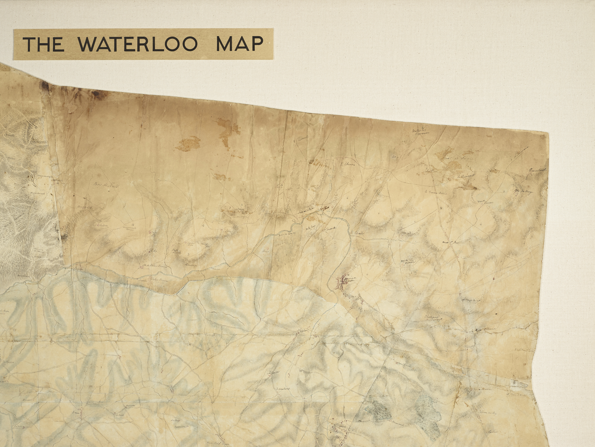


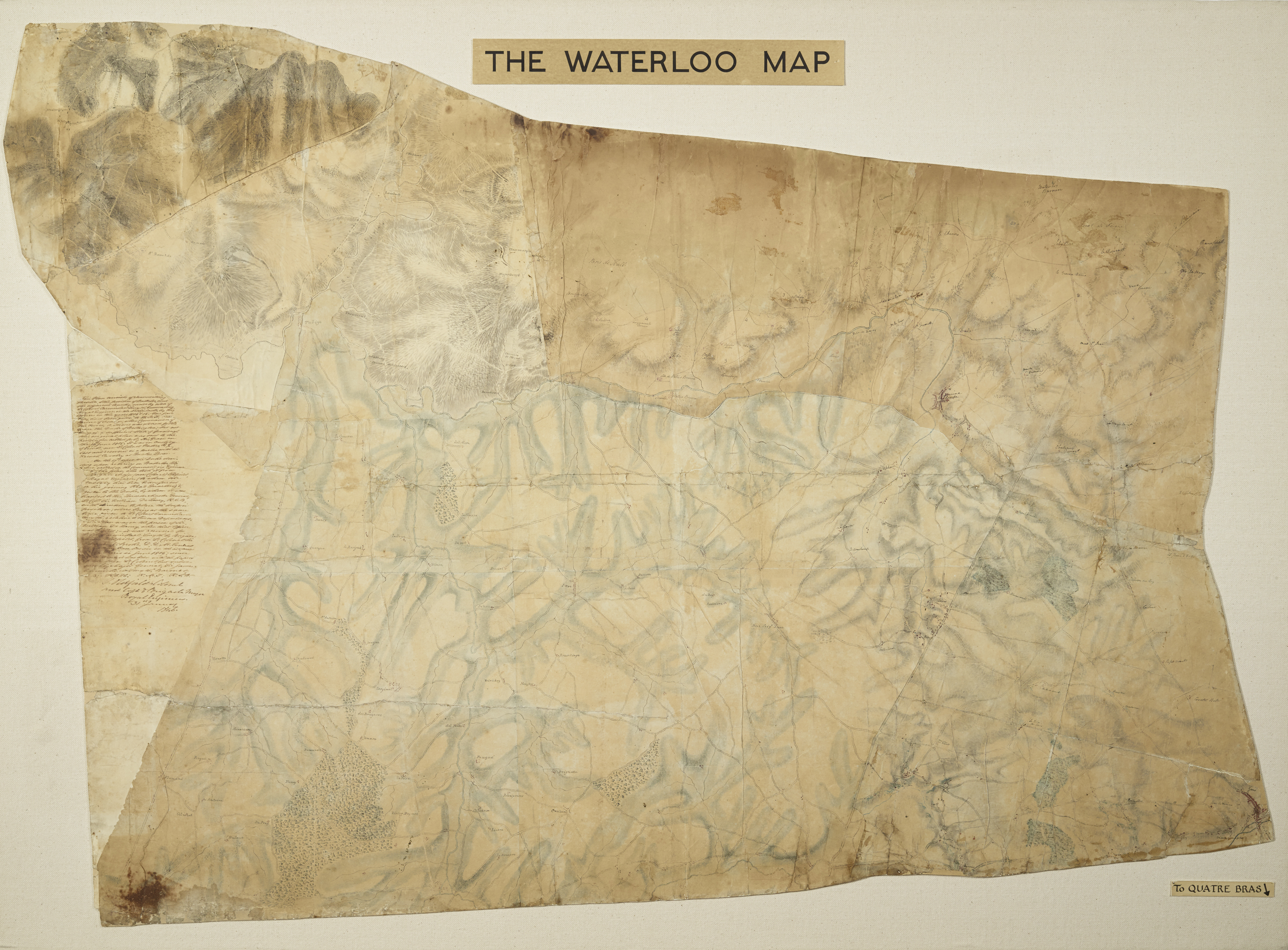
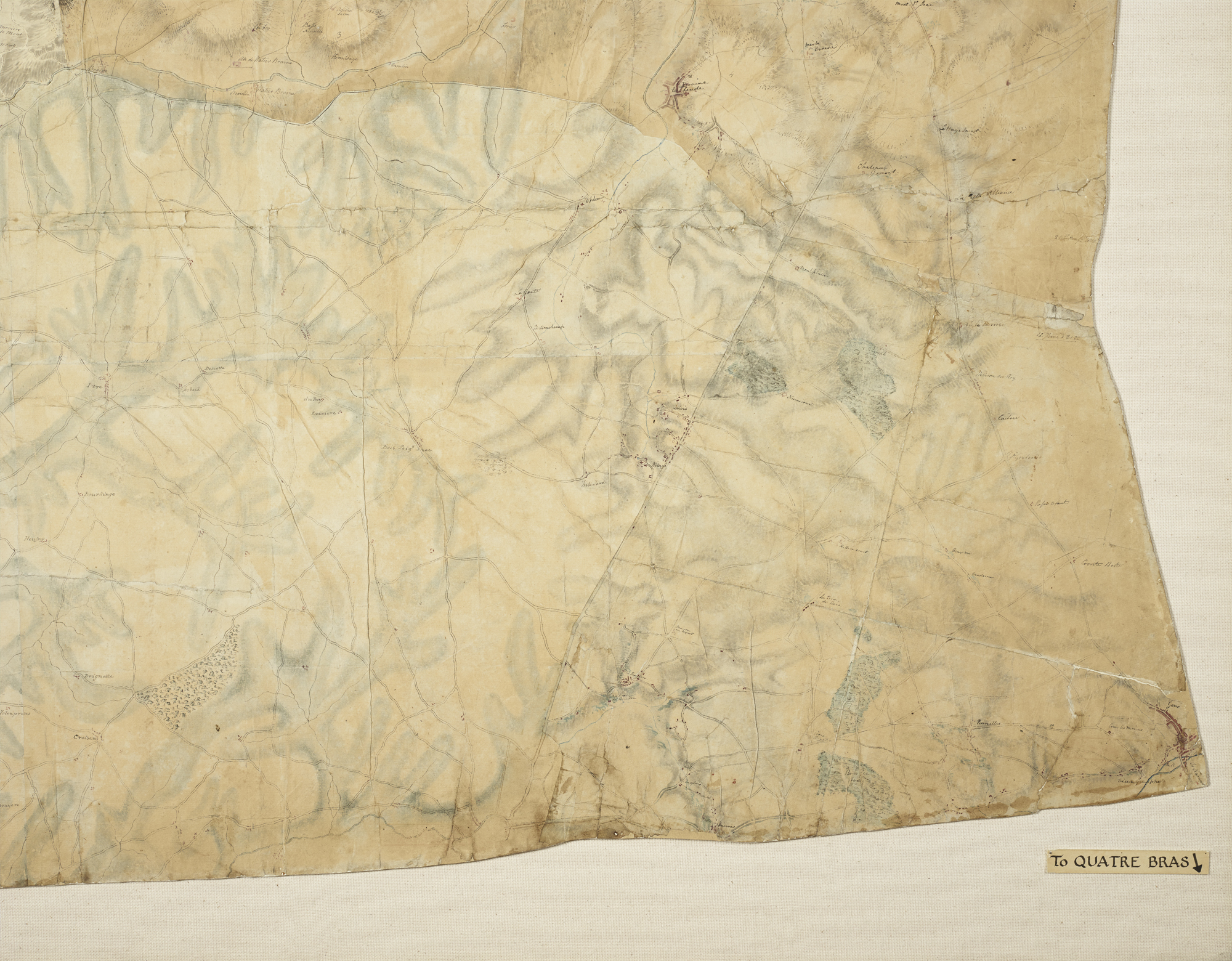
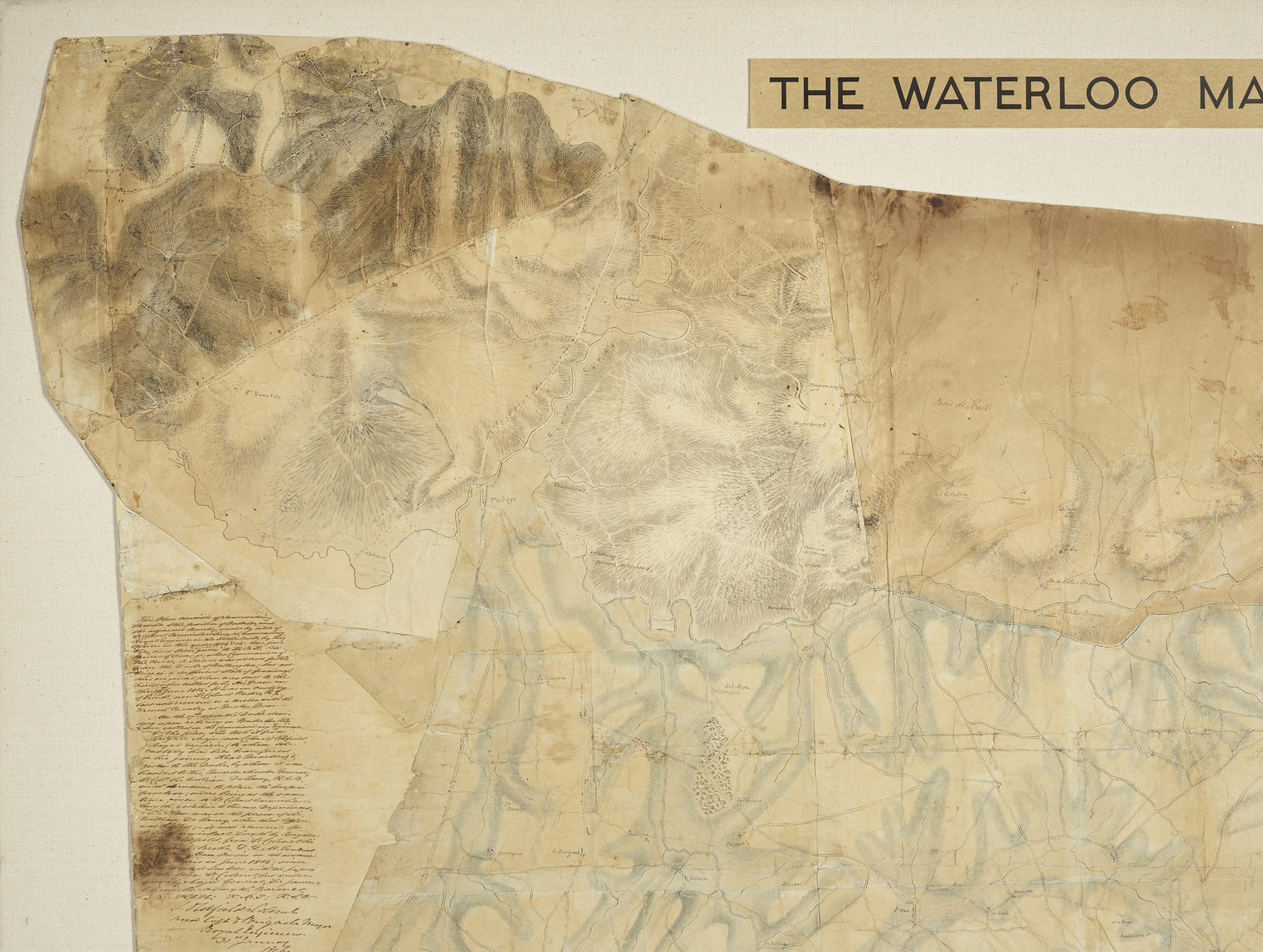
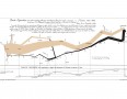
This is the original map used by the Duke of Wellington and his staff to plan and fight the Battle of Waterloo. It was carried on the battlefield by the British Quartermaster General, Sir William Howe De Lancey, who was mortally wounded by a cannonball near the end of the battle.
This map was created for the Duke of Wellington by the Royal Engineers. It is made up of ten smaller maps pasted together to create a single image. The Duke called for a detailed map of the area around Waterloo on the 16 June 1815, just two days before the battle. Various maps covering the region were hastily united and delivered to Wellington.
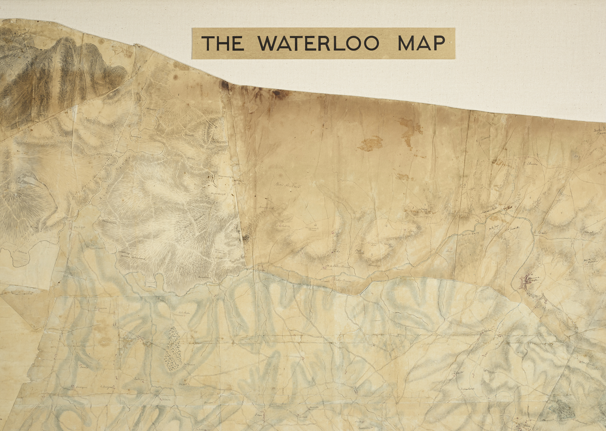
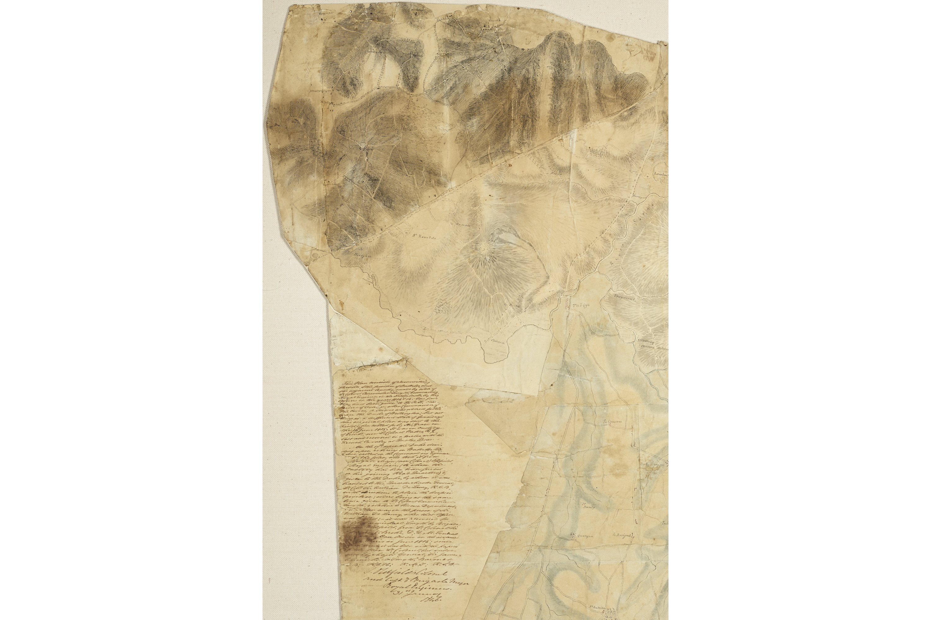
The pieces of the map were created by the British Royal Engineers between 1814 and 1815. Much of the map was drawn rather hurriedly, after Napoleon’s escape from the island of Elba. It was a field-sketched plan rather than a fully surveyed map. The latter procedure was time-consuming. It was made under the direction of Lieutenant Colonel Carmichael Smyth (commanding officer of the Royal Engineers in the Netherlands). The map’s dimensions are 135cm x 99cm and it covers an area of 120 square miles at a scale of 4 inches to the mile. The map was coloured with iron gall and black ink, graphite pencil, grey and green wash and red pigment.
A Lieutenant Waters delivered the map to Wellington after nearly losing it at the action at Quatre Bras. Head Curator of the Royal Engineers Museum Rebecca Nash describes the scene:
“So this young staff officer goes galloping off to Brussels and you get this sense of him bursting in breathless to the Royal Engineers depot where he meets a Major Oldfield of the Corps who doesn’t have a map of Quatre Bras but has several maps of nearby. So they hastily paste them all together and the young staff officer goes galloping back to Wellington.
“Unfortunately on his way back he runs into a bit of trouble with some French cavalry, loses his horse and knocks himself out. As he stirs and wakes up he realises his horse has disappeared but he soon finds it chomping on carrots in a field half a mile away with all the plans and maps still on it. He grabs the reins, jumps back in the saddle and heads back to Wellington.”
There is careful illustration of ground elevation, indicated by cross-hatching, which was used by the Duke of Wellington to plan where he should place his troops. The Duke indicated on the map, in pencil, some Allied troop dispositions, either for the benefit of De Lancey or the Prussians.
De Lancey was mortally injured by a cannonball during the Battle of Waterloo. The map was recovered by Brigade Major Oldfield and returned to Carmichael Smyth. There is a story that the top part of the map was stained with De Lancey’s blood.
The map remained with Lieutenant Colonel Sir Carmichael Smyth until his death in 1860, after which it disappeared. Resurfacing in 1910, it was donated to the Royal Engineers Museum. There was a copy made for the Prince of Orange and another copy made in 1846, which resides in the British Library.
Related Objects

-
Curatorial info
- Originating Museum: Royal Engineer's Museum
- Production Date: 1815
- Material: Canvas, ink
- Size: 135cm x 99cm
-
Use this image
You can download a higher resolution image below, but please note the conditions of the licence.
- Rights Holder: Royal Engineers Museum
- License Type: All Rights Reserved
Find it here
This object is in the collection of Royal Engineers Museum, Library and Archive