
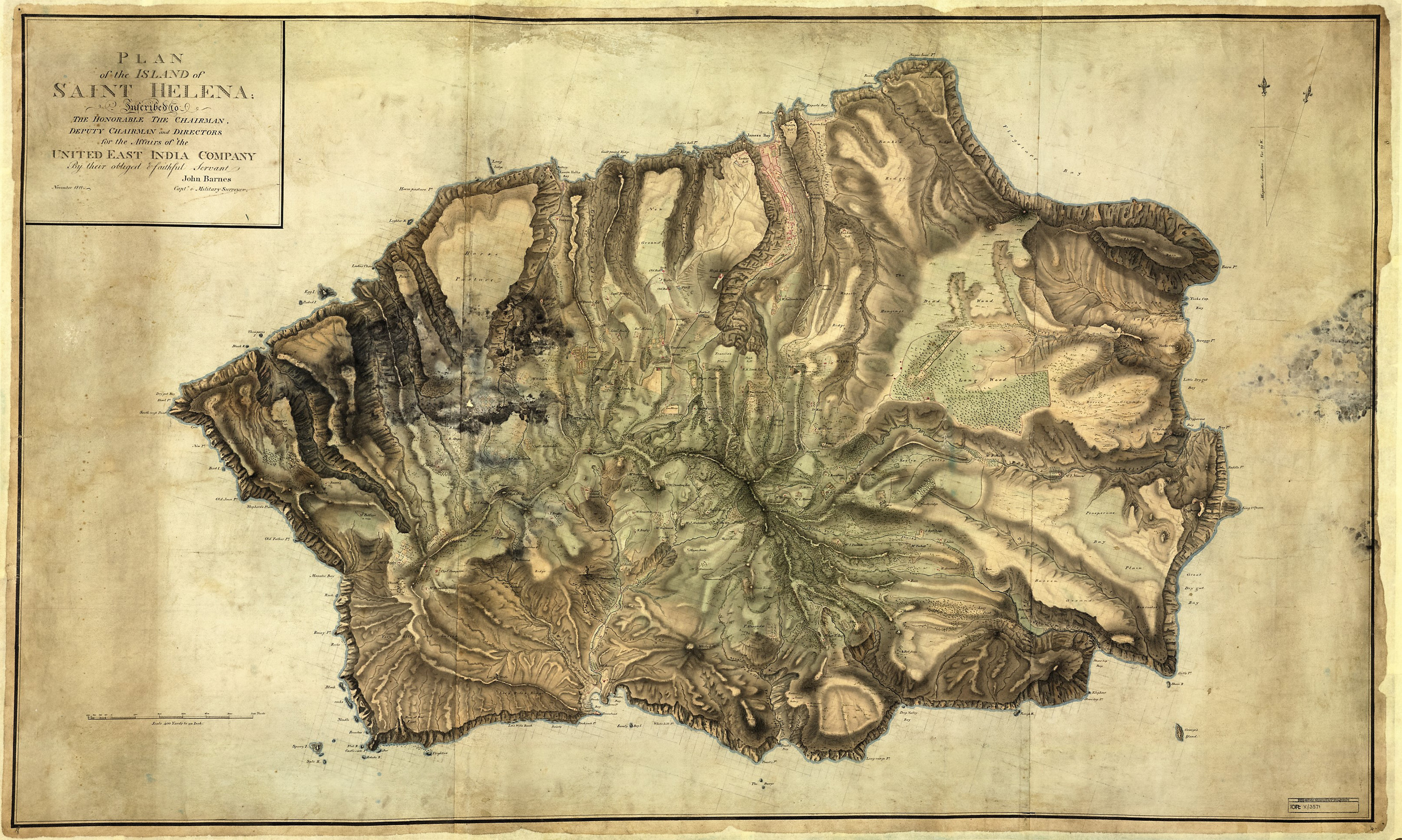
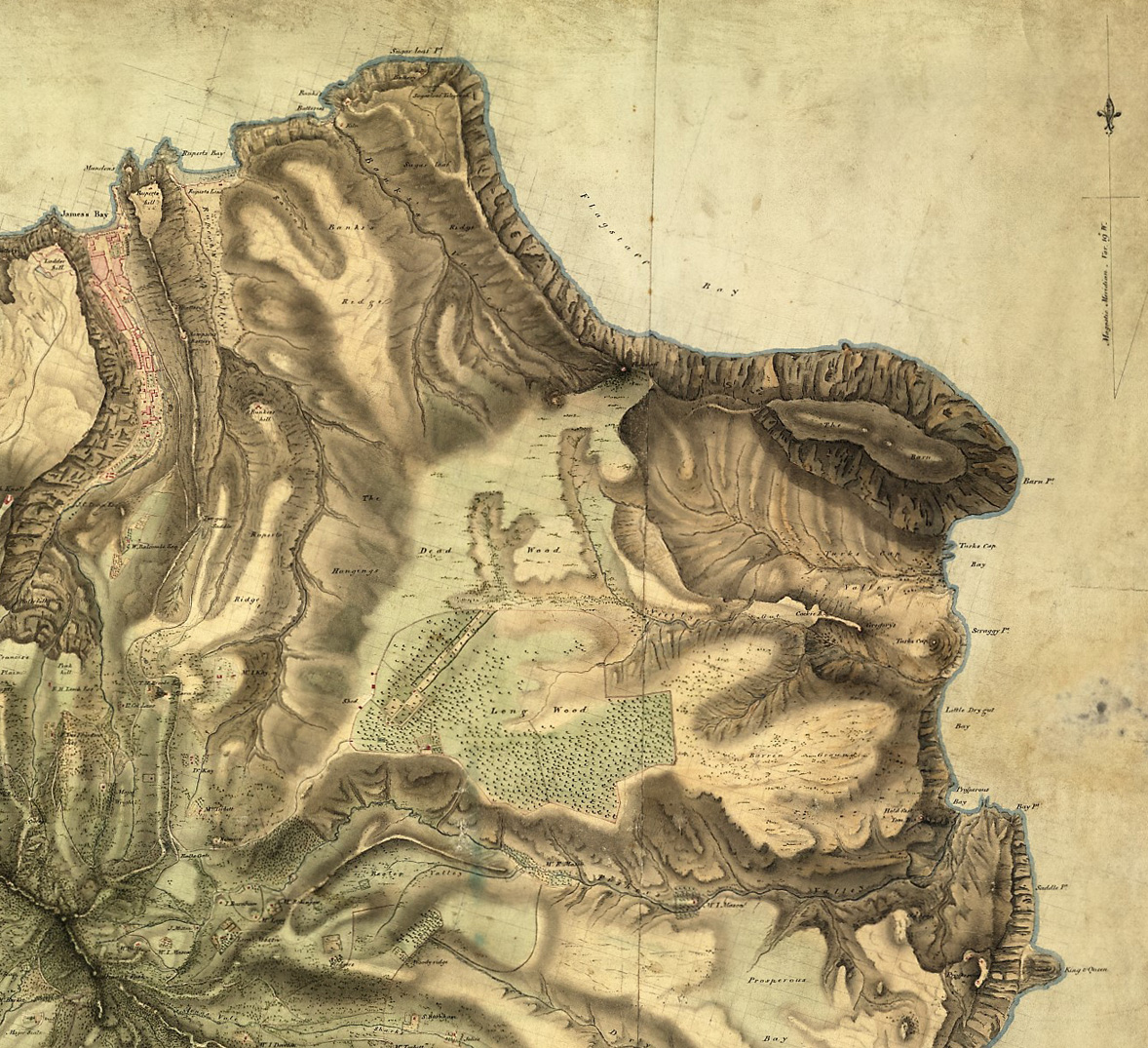
Map of St Helena made by Captain John Barnes in 1811
 The map of St Helena by Captain Barnes.
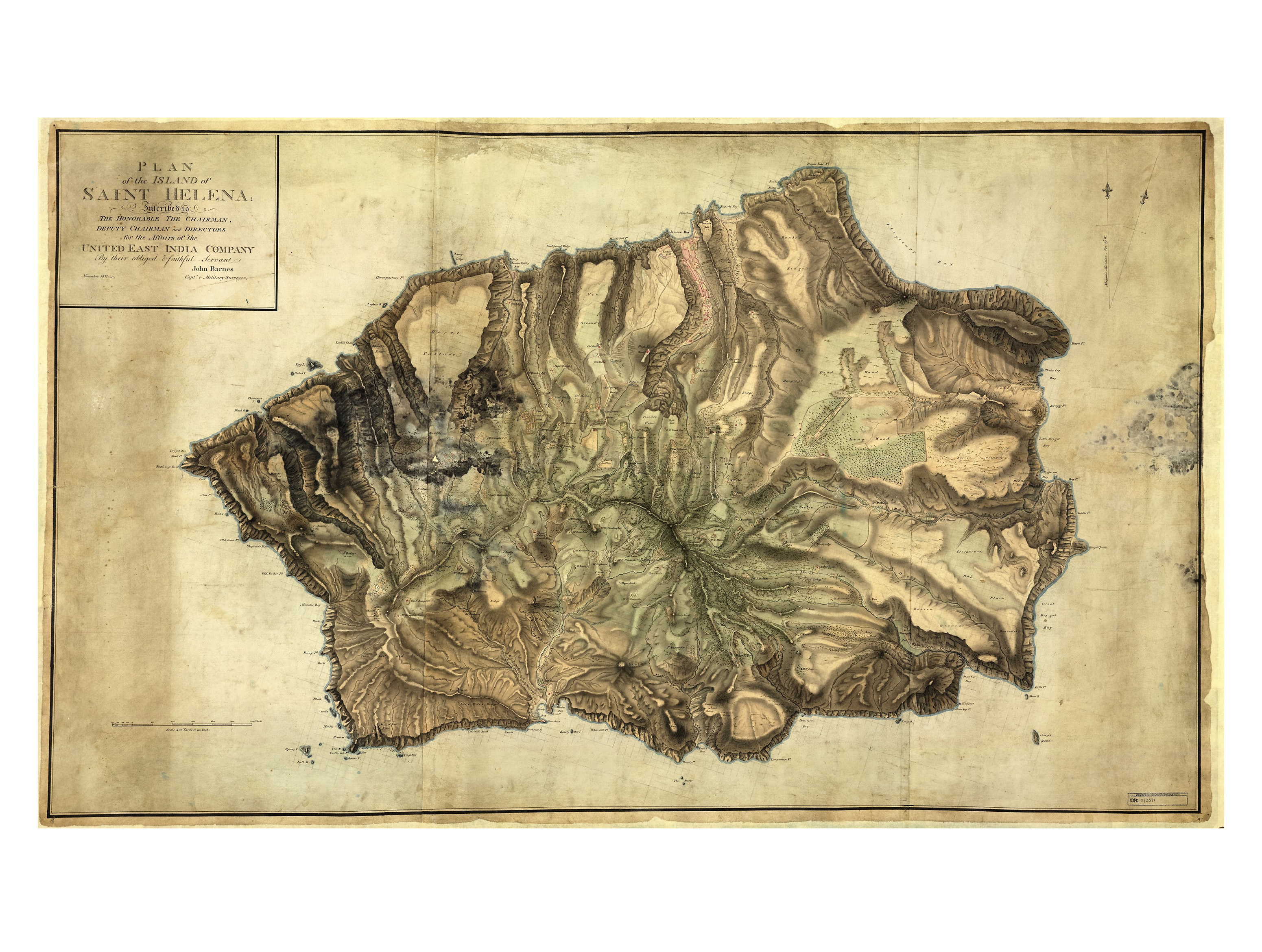
 Long Wood and the area around Napoleon's house on St Helena. © The British Library Board, X/3571.


A map of the volcanic island of St Helena, produced four years before the arrival of Napoleon Bonaparte.
In 1811 Captain John Barnes of the St Helena Artillery surveyed and produced this large and very accurate map of volcanic St Helena on behalf of the East India Company. The company garrisoned and maintained the island as a safe port and fresh watering station for their merchant ships. These carried goods from Britain to the Far East and brought back other goods. Vessels would anchor off James Town the only port on the island.
At the time the island was defended by the resident East India Company regiments of the St Helena Artillery and the St Helena Regiment providing gunners for the coastal batteries and an infantry battalion to counter any invasion attempt.
Most houses are named, not with a house name but with that of the principal male occupant. Consequently, we can see the homes of many people who would be present when Napoleon landed at James Town in October 1815.
Long Wood and Napoleon’s home can be found in the upper right hand quadrant of the map. The open plain is coloured in green to represent the thin covering of trees near the house and the grassland beyond. The dark colouring of the map also highlights the succession of narrow steep sided ridges that give the island its distinctive geography.
Barnes went on to publish, in London, an accompanying geography of the island in 1817 which also included information about the detention of Napoleon. What it did not contain was any information about the garrison which was increased by the arrival of two battalions of British army infantry and a troop of light cavalry. Even as a prisoner, Napoleon still exerted a powerful influence on his jailers.
Image © The British Library Board, X/3571.
-
Use this image
You can download and use the high resolution image for use in a non-profit environment such as a school or college, but please take note of the license type and rights holder information below
- Rights Holder: The British Library Board, X/3571.
- License Type: All Rights Reserved